OS Mapping
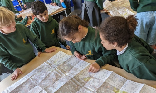
As our Global Trade geography topic has come to a close, we have started our new unit which focuses on map skills and the physical geography of our coasts. During our first lesson we learnt all about OS maps, what scale is, how to use a key and symbols and how to give a four or six figure grid reference! What a lot of new information. The children really enjoyed using the OS maps and were surprised to see how much bigger Richmond Park is compared to the common. They, of course, all enjoyed locating their houses and our school too.